

Product Details
- Product Number
- 206727
- Scale
- 1:650,000
- Alternate ID
- -
- Version Date
- 07/01/2011
- Regions
- AZ, CO, KS, NE, NM, OK, UT, WY
- Countries
- USA
- Media
- Paper
- Format
- Flat
- Digital Reproduction
- Yes
Additional Details
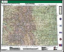
- Description
- Game management unit data were from the Colorado Division of Wildlife, dated February, 2006. County boundary data and cities were from the Colorado Department of Local Affairs, circa 2003. Highway data were from the Colorado Department of Transportation, circa 2003. Shaded relief was generated from the U.S. Geological Survey's National Elevation Dataset, circa 2004. Hydrography data were modified from the U.S. Geological Survey's National Atlas, circa 2004. Quadrangle names were from the Geographic Names Information System, dated April, 2006. Map compiled August, 2006 - USGS Central Region Geospatial Information Office, Denver , CO
- Survey Date
- 2011
- Height In Inches
- 35.000
- Length In Inches
- 43.000
- Boundary Type
- Political Unit
- Two Sided
- No
- Pieces
- 1
- Languages
- English
Related Items

LAKE TAHOE BASIN MANAGEMENT UNIT, CALIFORNIA AND NEVADA - ATLAS - 7½' QUADRANGLE TOPOGRAPHIC MAPS
