
CLEAR CREEK CORRIDOR, CO
$18.00
Available

Product Details
- Product Number
- 113849
- Series
- I-2760
- Scale
- NO SCALE
- Alternate ID
- I2760
- ISBN
- 978-0-607-98452-1
- Authors
- MELICK, R. A.
- Version Date
- 01/01/2002
- Regions
- CO
- Countries
- USA
- Media
- Paper
- Format
- Folded
Additional Details
- Description
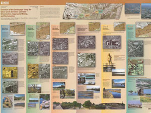
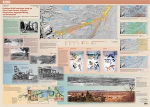
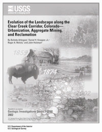
- Evolution of the Landscape along the Clear Creek Corridor, Colorado - Urbanization, Aggregate Mining, and Reclamation, I-2760 **** This report identifies land used and reclaimed by the mining industry along Clear Creek, from the foothills near Golden, Colorado to the confluence with the South Platte River north of Denver. **** Revealing a long and interesting history of the extraction of sand and gravel along Clear Creek over the last 100 years we are able to understand how the mining, reclamation, and the conversion of land use subsequently changed the landscape. **** Photographs, maps, journals, interviews, and fieldwork were used to examine aggregate mining, history, and ecology from 1900 to 2000 along lower Clear Creek. **** The booklet and two map sheets show various aspects of ecological and historical interest with black/white and color photographs of the study area. Aerial photographs help illustrate how sites have changed over the years. **** Booklet,,41 pages ** Sheet 1 ,,56"x39" ** Sheet 2 ,,56"x40" **
- Survey Date
- 2002
- Print Date
- 2002
- Languages
- English
Related Items

Historic Trail Maps of the Sterling 1 Degree by 2 Degrees Quadrangle, Northeastern Colorado

Historic trail map of the Lamar 1 degree by 2 degrees Quadrangle, Colorado and Kansas