Product Details
- Product Number
- 113455
- Scale
- 1:500,000
- Alternate ID
- -
- Authors
- CHARLES WRIGHT
- Version Date
- 01/01/1895
- Regions
- UT
- Countries
- USA
- Media
- Paper
- Format
- Flat
Additional Details
- Description
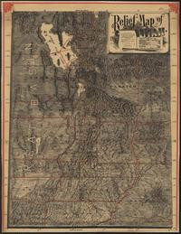
- Published by Pierce & McMillen, Salt Lake City, 1895. Drawn by Mosiah Hall, Superintendent of Schools, Weber County, and assisted by Charles Wright. County borders and minerals are illustrated on the map in red. Also included are demographics about the state and a statement that the map was "Designed for the home, the office, and especially for Schools." (Reproduction.)
- Survey Date
- 1895
- Print Date
- 1895
- Height In Inches
- 51.500
- Length In Inches
- 40.000
- Boundary Type
- Political Unit
- Two Sided
- No
- Pieces
- 1
Related Items


