

Product Details
- Product Number
- 113264
- Series
- MF-2377
- Scale
- NO SCALE
- Alternate ID
- MF-2377
- Authors
- DANA J. BOVE
- Version Date
- 01/01/2002
- Regions
- CO
- Countries
- USA
- Media
- Paper
- Format
- Flat
Additional Details
- Description
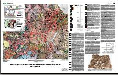
- Normal;Generalized Geologic Map of Part of the Upper Animas River Watershed and Vicinity, Silverton, Colorado
- Survey Date
- 2002
- Print Date
- 2002
- Height In Inches
- 29.000
- Length In Inches
- 48.000
Related Items

SURFICIAL GEOLOGIC MAPS ALONG THE RIPARIAN ZONE OF THE ANIMAS RIVER AND ITS HEADWATER TRIBUTARIES, SILVERTON TO DURANGO, COLORADO, WITH UPPER ANIMAS RIVER WATERSHED GRADIENT PROFILES

Ferricrete, Manganogrete, Bog Iron Occurrences With Selected Sedge Bogs and Active Iron Bogs and Springs in the Upper Animas River Watershed, San Juan County, Colorado
Net Acid Production, Acid Neutralizing Capacity, and Associated Mineralogical and Geochemical Characteristics of Animas River Watershed Igheous Rocks Near Silverton, Colorado