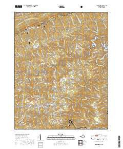

Product Details
- Product Number
- 104004
- Series
- TVA QUAD# 195-NW
- Scale
- 1:24,000
- Alternate ID
- TVA0199
- ISBN
- 978-0-607-56080-0
- Version Date
- 01/01/1977
- Regions
- KY, VA
- Countries
- USA
- Media
- Paper
- Format
- Flat
- Digital Reproduction
- Yes
Additional Details
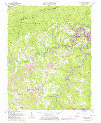
- Description
- CLINTWOOD, VA-KY HISTORICAL MAP GEOPDF 7.5X7.5 GRID 24000-SCALE 1963
- Survey Date
- 1963
- Print Date
- 1978
- Height In Inches
- 26.900
- Length In Inches
- 22.100
- Boundary Type
- Quadrangle
- Two Sided
- No
- Pieces
- 1
- Languages
- English
Related Items