
UNDERSTANDING MAPS AND SCALES

UNDERSTANDING MAPS AND SCALES
MAP PROJECTIONS (FOLDED)
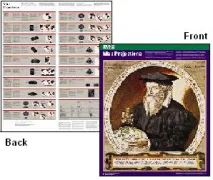
MAP PROJECTIONS <p> <p> A map projection is used to portray all or part of the round Earth on a flat surface. This can not be done without some distortion. Every projection has its own set of advantages and disadvantages. There is no "best" projection. The mapmaker must select the one best suited to the needs, reducing distortion of the most important features. <p> <p> Mapmakers and mathematicians have devised almost limitless ways to project the image of the globe onto paper. Scientists at the U.S. Geological Survey have designed projections for their specific needs - such as the Space Oblique Mercator, which allows mapping from satellites with little or no distortion. <p> <p> This document gives the key properties, characteristics, and preferred uses of many historically important projections and of those frequently used by mapmakers today. <p> <p> Map Projections is a great learning tool for schools, conferences and special events. It is offered free of charge in limited quantities, but does come with a $5.00 handling charge for each order mailed. <p>
GROUND WATER: THE HIDDEN RESOURCE (B/W)
GROUND WATER: THE HIDDEN RESOURCE (BLACK & WHITE)
WATER: THE RESOURCE THAT GETS USED (M/S)
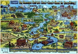
WATER: THE RESOURCE THAT GETS USED & USED & USED FOR EVERYTHING! (MIDDLE SCHOOL)
WATERSHEDS: WHERE WE LIVE (B/W)
WATERSHEDS: WHERE WE LIVE (BLACK AND WHITE) POSTER
IMAGES OF THE USGS, 1879-1979
IMAGES OF THE USGS, 1879-1979 (56P.)
AQUATIC CONTAMINANTS IN COLLOI
TECHNOLOGY TRANSFER OPPORTUNITIES: PARTNERSHIPS AQUATIC CONTAMINANTS IN COLLOIDAL PHASES AND HUMIC COMPLEXES
USGS TECHNOLOGY NWQ LABORATORY
TECHNOLOGY TRANSFER OPPORTUNITIES: PARTNERSHIPS USGFS TECHNOLOGY NATIONAL WATER QUALITY LABORATORY
TECHNOLOGY TRANSFER OPPORTUNIT
Technology transfer opportunities: partnership opportunities available at the USGS
GRND-WTR RES OF GALLATIN, MT
Ground-water resources of the Gallatin local water quality district, southwestern Montana
DELAWARE, DE
Delaware
DIGITAL DATABASE OF COAL OWNER, US
Federal Coal in the United States: A Digital Database of Coal Ownership Status
USGS PROGRAMS IN MICHIGAN, MI
U. S. Geological Survey programs in Michigan
USGS PROGRAMS IN MINNESOTA, MN
U.S. Geological Survey programs in Minnesota
GEOLOGIC FRAMEWORK LAKE PONCHARTRAIN, LA
Geologic framework and processes of Lake Pontchartrain, Louisiana