
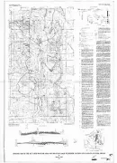
BULLS PASS QUAD, UT, UT

Geologic map of the Bulls Pass Quadrangle, Box Elder County, Utah
ANDREWS MOUNTAIN, MIN RES POTE, CA
Mineral resource potential map of the Andrews Mountain, Mazourka, and Paiute Roadless Areas, Inyo County, California
BLOOD MOUNTAIN, MIN RES POT, GA
Mineral resource potential map of the Blood Mountain roadless area, Union and Lumpkin Counties, Georgia
BIG SANDY/W ELLIOTTS-MIN RESOU, AL
Mineral resource potential map of the Big Sandy, West Elliotts Creek, and Reed Brake Roadless Areas, Tuscaloosa, Hale and Bibb counties, Alabama
SKY LAKES ROADLESS AREA, OR
Geologic map of the Sky Lakes roadless area and Mountain Lakes Wilderness, Jackson and Klamath counties, Oregon
CORNPLANTER ROADLESS-GEOCHEMIC, PA
Geochemical maps of the Cornplanter Roadless Area, Warren County, Pennsylvania
LOCATE-PHOTO & RECONN GEOLOGIC, MT
Photogeologic and reconnaissance geologic map of the Locate Quadrangle, Custer County, Montana
DRAGOON MOUNTAINS, GEOPHYS, AZ
Geophysical maps of the Dragoon Mountains Roadless Area, Cochise County, Arizona
MINE MAP OF CHAMA RIVER CANYON, NM
Mine and prospect map of the Chama River Canyon Wilderness and contiguous roadless area, Rio Arriba County, New Mexico
ORLEANS MOUNTAIN, MIN RES POT, CA
Mineral resource potential map of the Orleans Mountain Roadless Area, Humboldt and Siskiyou counties California
SOUTHERN MASSANUTTEN-MINES, VA
Maps showing mines and prospects in the Southern Massanutten Roadless Area, Page and Rockingham counties, Virginia
MOUNT EDDY, GEOCHEM MAP, CA
Geochemical map of the Mount Eddy and Castle Crags Roadless Areas, Shasta, Siskiyou, and Trinity counties, California
OCEANOGRAPHER CANYON N PART, MA
Submarine topography, surficial geology, and fauna of Oceanographer Canyon, northern part
MOUNT EDDY, CA
Geologic map of the Mount Eddy and Castle Crags Roadless Areas, Shasta, Siskiyou, and Trinity counties, California
UGASHIK, BRISTOL BAY, KARLUK, AK
Maps and tables showing data and analyses of semi-quantitative emmission spectrometry and atomic-absorption spectrophotometry of rock samples, Ugashik, Bristol Bay, and part of Karluk quadrangles, Alaska