
CONTROLLED PHOTOMOSAIC LUNAE PLANUM MARS
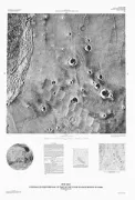
Controlled photomosaic of part of the Lunae Planum region of Mars, MTM 10072
ATLAS GULF OF MEXICO CARIBBEAN AREAS, US

Atlas of the U.S. Exclusive Economic Zone, Gulf of Mexico and eastern Caribbean areas
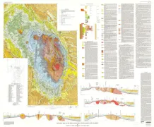
NEVADA TEST SITE-UNDER GRND EX, NV
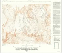
Map showing surface features induced by underground nuclear explosions at Pahute Mesa, Nevada Test Site, Nye County, Nevada, April 1976 through December 1983
YOSEMITE NATIONAL PARK-OBL.VIEW GLAC.,CA
Oblique map showing maximum extent of 20,000-year-old (Tioga) glaciers, Yosemite National Park, central Sierra Nevada, California
SHADED RELIEF MARE BOREUM REGION MARS
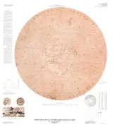
Controlled photomosaic and revised shaded relief map of the Mare Boreum region of Mars
SALEM, GEOLOGIC MAP, OR
Geologic map of the Salem 1 degree by 2 degrees Quadrangle, western Oregon
GEOLOGIC MAP OF THE SEDONA QUADRANGL, AZ
Geologic map of the Sedona 30' x 60' Quadrangle, Yavapai and Coconino counties, Arizona
SHADED RELIEF MARKINGS PERRINE GANYMEDE
Shaded relief and surface markings of the Perrine Quadrangle of Ganymede
ANGEL RAPIDS - HYDRAULIC MAP, AZ
Hydraulic map of Bright Angel Rapids, Grand Canyon, Arizona
GRANITE RAPIDS - HYDRAULIC MAP, AZ
Hydraulic map of Granite Rapids, Grand Canyon, Arizona
SHERBROOKE-LEWISTON LITHOFACIE, ME
TECTONIC LITHOFACIES, GEOPHYSICAL, AND MINERAL-RESOURCE APPRASAL MAPS OF THE SHERBROOKE-LEWISTON AREA, ME, NH, AND VT,
RICHFIELD, GEOLOGIC MAP, UT
Geologic map of the Richfield 1 degree by 2 degrees Quadrangle, west-central Utah
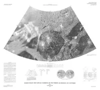
SOUTHERN HEMISPHERES URANIAN SATELLITES
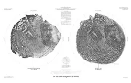
The Southern hemispheres of the Uranian satellites
GEOLOGIC MAP OF BLACK HILLS AREA, SD, WY
Geologic map of the Black Hills area, South Dakota and Wyoming
CONTROLLED MOSAIC NILOSYRTIS MENSAE MARS
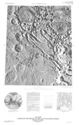
Controlled photomosaic of part of the Nilosyrtis Mensae region of Mars, MTM 35302