
Added MILLERSBURG, KY to cart. View cart.
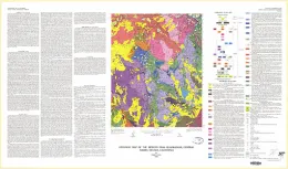
GEOLOGIC MAP PLUG HAT ROCK QUADRANGL, CO

Geologic map of the Plug Hat Rock quadrangle, Moffat County, Colorado
MERCED PEAK, CA
Geologic map of the Merced Peak quadrangle, central Sierra Nevada, California
STUNTZ RESERVOIR, UT
Geologic map of the Stuntz Reservoir quadrangle, Utah-Colorado
MCCARTHY C-7, AK
Geologic map of the McCarthy C-7 quadrangle, Alaska
SOUDAN, MN
Geologic map of the Soudan quadrangle, St. Louis County, Minnesota
HAMPDEN - SURFICIAL GEOLOGIC, MA
Surficial geologic map of the Hampden quadrangle, Massachusetts and Connecticut
BECKER, NM
Geologic map of the Becker quadrangle, Valencia and Socorro Counties, New Mexico
LAKE HELEN, WY
Geologic map of the Lake Helen quadrangle, Big Horn and Johnson Counties, Wyoming
EAST LEE - BEDROCK GEOLOGY, MA
Bedrock geologic map of the East Lee quadrangle, Berkshire County, Massachusetts
PITTSFIELD EAST - BEDROCK GEOL, MA
Bedrock geologic map of the Pittsfield East quadrangle, Berkshire County, Massachusetts
GEOLOGIC MAP MAMMOTH QUADRANGLE, WV
Geologic map of the Mammoth quadrangle, Kanawha and Clay Counties, West Virginia
GEOLOGIC MAP STALLSVILLE QUADRANGLE, SC
Geologic map of the Stallsville quadrangle, Dorchester and Charleston Counties, South Carolina
GEOLOGIC MAP HURRICANE QUADRANGLE, WI
Geologic map of the Hurricane quadrangle, Grant County, Wisconsin
GEOLOGIC MAP GREENWICH QUADRANGLE, UT
Geologic map of the Greenwich quadrangle, Piute County, Utah
GEOLOGIC MAP CROWNPOINT QUADRANGLE, NM
Geologic map of the Crownpoint quadrangle, McKinley County, New Mexico