
WASHINGTON EAST, DC-MD

WASHINGTON EAST, DC-MD HISTORICAL MAP GEOPDF 7.5X7.5 GRID 24000-SCALE 1957
WASHINGTON EAST, DC-MD
WASHINGTON EAST, DC-MD HISTORICAL MAP GEOPDF 7.5X7.5 GRID 24000-SCALE 1965
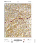
ANACOSTIA, DC-MD
ANACOSTIA, DC-MD HISTORICAL MAP GEOPDF 7.5X7.5 GRID 31680-SCALE 1945
ANACOSTIA, DC-MD
ANACOSTIA, DC-MD HISTORICAL MAP GEOPDF 7.5X7.5 GRID 24000-SCALE 1965
WASHINGTON WEST, DC-MD-VA
WASHINGTON WEST, DC-MD-VA HISTORICAL MAP GEOPDF 7.5X7.5 GRID 24000-SCALE 1956
WASHINGTON WEST, DC-MD-VA
WASHINGTON WEST, DC-MD-VA HISTORICAL MAP GEOPDF 7.5X7.5 GRID 24000-SCALE 1965
WASHINGTON, DC-MD-VA
WASHINGTON, DC-MD-VA HISTORICAL MAP GEOPDF 1X2 GRID 250000-SCALE 1961
WASHINGTON EAST, DC-MD
WASHINGTON EAST, DC-MD HISTORICAL MAP GEOPDF 7.5X7.5 GRID 24000-SCALE 1965
FAMOUS BUILDING STONES NATIONS CAPITAL
Famous Building Stones of Our Nation's Capital <p> By U.S. Geological Survey <p> </p> <font color=red><i> <p> This product is not available for order, it can only be downloaded from here (click on image) or within the Publications Warehouse at http://pubs.usgs.gov/fs/2012/3044/ </p> </i> </font>
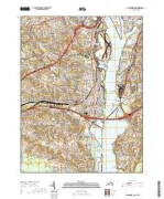
ANACOSTIA, DC-MD
ANACOSTIA, DC-MD TNM GEOSPATIAL PDF 7.5X7.5 GRID 24000-SCALE 2015
ALEXANDRIA, VA-DC-MD
ALEXANDRIA, VA-DC-MD TNM GEOSPATIAL PDF 7.5X7.5 GRID 24000-SCALE 2016
BUILDING STONES OF OUR NATION'S CAPITAL
BUILDING STONES OF OUR NATION'S CAPITAL
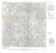
SELECTED HERBICIDES IN MAJOR, DC
Selected herbicides in major streams in the Potomic River Basin upstream from Washington, D.C.
CHESAPEAKE BAY WATERSHED: 64,000 SQ, VA
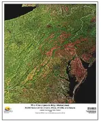
THE CHESAPEAKE BAY WATERSHED: 64,000 SQUARE MILES OF LAND, WATER, WILDLIFE, AND PEOPLE "A BETTER BAY THRU BETTER SCIENC
LAND USE CHANGE MAP, 1970-1972, DC
Land Use Change Map, 1970-1972, Washington Urban Area, D.C., Maryland, and Virginia