
GEOLOGIC MAP VALLES MARINERIS E&W MARS
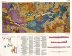
Geologic Map of the Valles Marineris Region, Mars
EMERY-7, PHOTOGEOLOGIC, UT

Photogeologic map of the Emery-7 quadrangle, Emery County, Utah
KAIPAROWITS PEAK-8, PHOTOGEOL, UT
Photogeologic map of the Kaiparowits Peak-8 quadrangle, Garfield County, Utah
CIRCLE CLIFFS-1, PHOTOGEOLOGIC, UT
Photogeologic map of the Circle Cliffs-1 quadrangle, Garfield County, Utah
CIRCLE CLIFFS-9, PHOTOGEOLOGIC, UT
Photogeologic map of the Circle Cliffs-9 quadrangle, Garfield County, Utah
CIRCLE CLIFFS-13, PHOTOGEOLOGI, UT
Photogeologic map of the Circle Cliffs-13 quadrangle, Garfield and Kane Counties, Utah
CIRCLE CLIFFS-15, PHOTOGEOLOGI, UT
Photogeologic map of the Circle Cliffs-15 quadrangle, Garfield and Kane Counties, Utah
CIRCLE CLIFFS-16, PHOTOGEOLOGI, UT
Photogeologic map of the Circle Cliffs-16 quadrangle, Garfield and Kane Counties, Utah
WHITE CANYON-1, PHOTOGEOLOGIC, UT
Photogeologic map of the White Canyon-1 quadrangle, San Juan and Garfield Counties, Utah
STRAIGHT CLIFFS-9, PHOTOGEOLOG, UT
Photogeologic map of the Straight Cliffs-9 quadrangle, Kane County, Utah
NAVAJO MOUNTAIN-3, PHOTOGEOLOG, UT
Photogeologic map of the Navajo Mountain-3 quadrangle, Kane and San Juan Counties, Utah
MT PENNELL-11, PHOTOGEOLOGIC, UT
Photogeologic map of the Mt. Pennell-11 quadrangle, Garfield County, Utah
MT PENNELL-12, PHOTOGEOLOGIC, UT
Photogeologic map of the Mt. Pennell-12 quadrangle, Garfield County, Utah
STRAIGHT CLIFFS-7, PHOTOGEOLOG, UT
Photogeologic map of the Straight Cliffs-7 quadrangle, Kane County, Utah
CIRCLE CLIFFS-12, PHOTOGEOLOG, UT
Photogeologic map of the Circle Cliffs-12 quadrangle, Garfield County, Utah