
PLATTE RIVER DRAINAGE BASIN, CO (FOLDED)
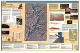
Pleistocene glaciation in the upper Platte River drainage basin, Colorado- Folded Version
CRATER LAKE REVEALED, OR
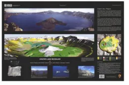
CRATER LAKE REVEALED
THIS DYNAMIC PLANET - WORLD MAP OF VOLCA
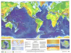
This Dynamic Planet World Map of Volcanoes, Earthquakes, Impact Craters, and Plate Tectonics
SATELLITE IMAGE MAP OF PAKISTAN
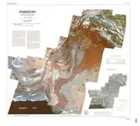
Satellite image map of Pakistan
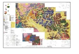
SURFICIAL DEPOSITS IN EASTERN CENTRAL US
MAP OF SURFICIAL DEPOSITS AND MATERIALS IN THE EASTERN AND CENTRAL UNITED STATES (EAST OF 102 DEGREES WEST LONGITUDE)
QUATERNARY-ACTIVE FAULTS SAN FRANCISCO
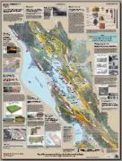
Map of Quaternary-active Faults in the San Francisco Bay Region
UNDER THE GOLDEN GATE BRIDGE, SEA FLOOR
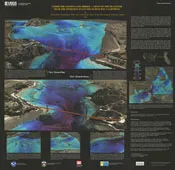
Under the Golden Gate Bridge-Views of the Sea Floor near the entrance to San Francisco Bay, California
VIEWS OF SEA FLOOR MONTEREY BAY, CA
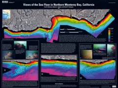
Views of the Sea Floor in Northern Monterey Bay, California
GEOLOGIC MAP COLLEGIATE PEAKS WILDERNESS
Geologic map of the Collegiate Peaks Wilderness Area and the Grizzly Peak Caldera, Sawatch Range, central Colorado
NORTH AMERICA TAPESTRY OF TIME & TERRAIN
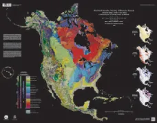
THE NORTH AMERICA TAPESTRY OF TIME AND TERRAIN
GEOLOGIC MAP SAN FRANCISCO BAY REGION
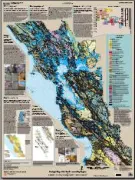
Geologic Map of the San Francisco Bay Region
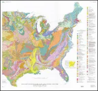
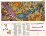
GEOLOGY OF THE SOUTHERN APPALACHIAN MTS
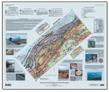
GEOLOGY OF THE SOUTHERN APPALACHIAN MOUNTAINS
GEOLOGIC MAP VALLES MARINERIS E&W MARS
Geologic Map of the Valles Marineris Region, Mars
RECONNAISSANCE GEOLOGIC MAP MOUNT RABOT
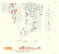
Reconnaissance geologic map of the Mount Rabot Quadrangle, Transantarctic mountains, Antarctica Antarctic Map 1 By: P. J. Barrett, J.F. Lindsay, and John Gunner https://doi.org/10.3133/a1
ALEXANDRA MOUNTAINS
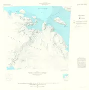
Reconnaissance geologic map of the Alexandra Mountains Quadrangle, Marie Byrd Land, Antarctica